
Follow Your Own Compass.
Vehicles built for overlanding are the perfect platform for the
independent and adventurous traveler to explore Alaska!
Adventure awaits. Where will you go?
Destinations and Maps
—————————————
North of Anchorage - Talkeetna, Denali Park, Fairbanks
-

Anchorage to Talkeetna, 115 miles, 2.5 hours
Talkeetna is located at the confluence of three rivers, the Susitna, Chulitna and Talkeetna. Talkeetna began in 1916 when the area was chosen as a district headquarters for the Alaska Railroad. A post office opened as well as a sawmill, trading post, cigar and donkey store and other businesses as well as many cabins. In 1917, the residents encouraged the government to survey the lots on which their homes stood. In 1919, the railroad surveyed and auctioned eighty lots, 41 of which already had permanent structures on them. Learn more.
-

Anchorage to Denali Park, 265 miles, 4-5 hours
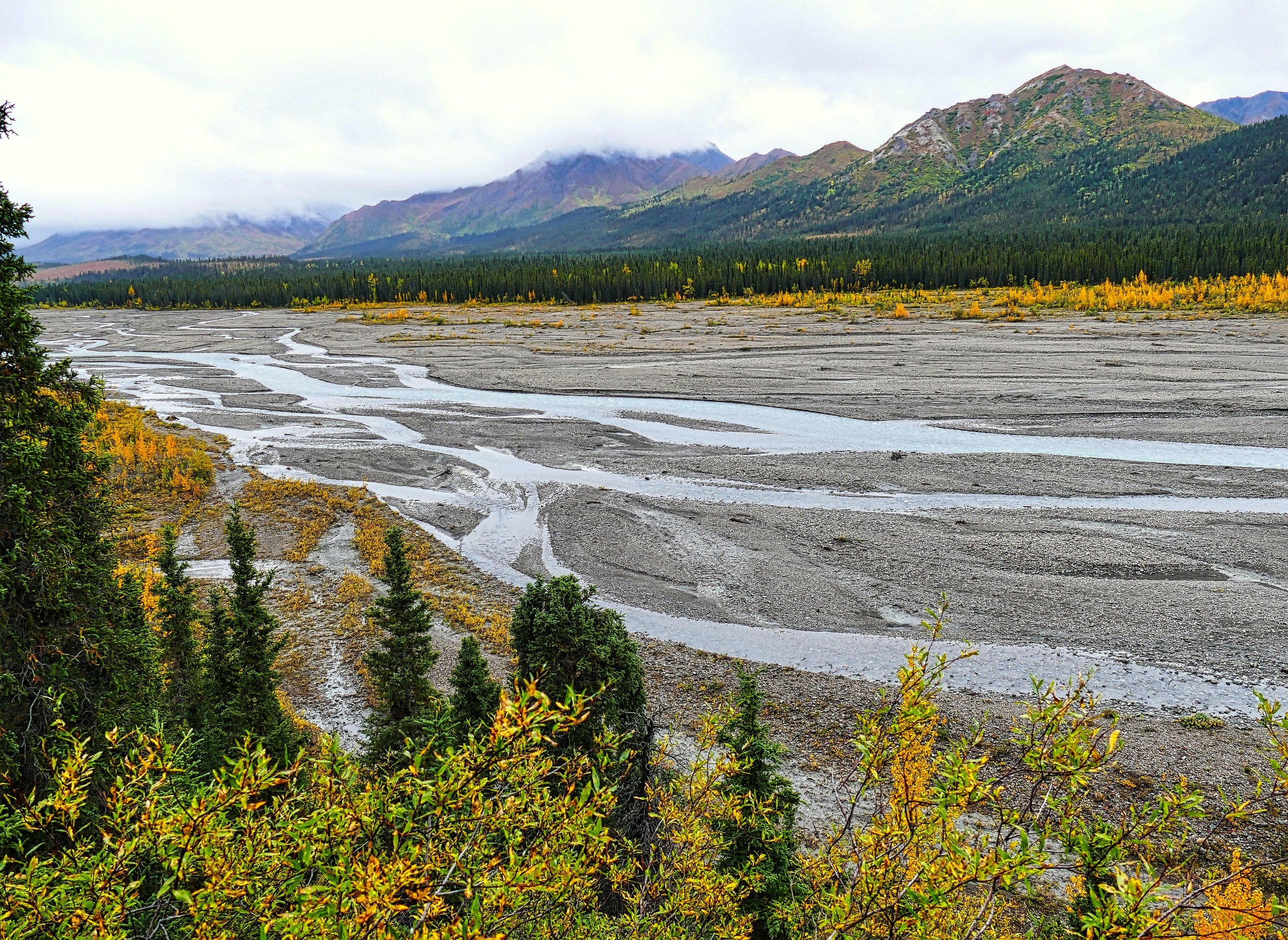
Denali National Park and Preserve, formerly known as Mount McKinley National Park, is an American national park and preserve located in Interior Alaska, centered on Denali, the highest mountain in North America. The park and contiguous preserve encompass 9,446 sq miles; which is larger than the state of New Hampshire. Denali's landscape is a mix of forest at the lowest elevations, including deciduous taiga, with tundra at middle elevations, and glaciers, snow, and bare rock at the highest elevations. Learn more.
-

Anchorage to Fairbanks - 360 miles, 7-8 hours
Fairbanks is the largest and coldest city in the Interior region of Alaska and the second largest in the state. The 2020 Census put the population of the city proper at 32,515, and the population of the Fairbanks North Star Borough at 95,655 making it the second-most populous metropolitan area in Alaska after Anchorage. The Metropolitan Statistical Area encompasses all of the Fairbanks North Star Borough and is the northernmost Metropolitan Statistical Area in the United States, located 140 mi by air south of the Arctic Circle. Learn more.
South of Anchorage - Portage, Seward, Cooper Landing, Homer
-

Anchorage to Girdwood, 40 miles, 1 hour
Girdwood is a resort town within the southern extent of the Municipality of Anchorage. Originally called "Glacier City," Girdwood was founded as a supply camp for placer gold miners with claims along the creeks feeding Turnagain Arm. It was renamed for Colonel James Girdwood, a Belfast-born, Scots-Irish entrepreneur and linen merchant who staked the first four gold claims along Crow Creek in 1896.
The town was moved 2.5 miles up the valley after the devastating Good Friday earthquake of 1964, when the land under the original townsite subsided into Turnagain Arm, putting much of the town below high tide. Learn more.
-

Anchorage to Whittier, 60 miles, 1.5 hours
During World War II, the United States Army constructed a military facility, complete with port and railroad, near Whittier Glacier and named the facility Camp Sullivan. The spur of the Alaska Railroad to Camp Sullivan was completed in 1943, and the port became the entrance for United States soldiers into Alaska.
The 13,300 foot Whittier tunnel is the only land access to the town. It’s the longest combined rail and highway tunnel in North America
At the 2020 census, the population was 272, up from 220 in 2010, almost all of whom live in a single building, the Begich Towers. Learn more.
-

Anchorage to Seward, 128 miles, 2.5-3 hours
Seward is the site of an annual salmon run that, in the 1920s, came to "countless millions" and supported a community of fishermen of mainly Scandinavian origin.
Seward is among the most lucrative commercial fisheries ports in the United States, according to reports from the National Marine Fisheries Service. Per the most recent year data available, for 2016, commercial fishing boats in Seward offloaded approximately 13,500 tons of fish and shellfish, valued at about $42 million.[12] Over the course of the decade from 2007 to 2016, around $545 million in commercial seafood passed through Seward's harbor. Learn more.
-

Anchorage to Cooper Landing, 100 miles, 2.5 hours
Cooper Landing is located in the north-central part of the Kenai Peninsula. The center of the community is at the west end of Kenai Lake, where the lake flows into the Kenai River.
Alaska Route 1, the Sterling Highway, passes through the community, leading north 102 miles to Anchorage and southwest 120 miles to Homer. Soldotna, the Kenai Peninsula Borough seat, is 45 miles to the west on AK-1, and Seward is 47 miles to the southeast via routes 1 and 9.
Learn more. -

Anchorage to Kenai, 158 miles, 3 hours
In 1985, a world record largest sport-caught Chinook (or "king") salmon was taken from the Kenai River, weighing in at 97 lbs 4oz. Eight of the ten largest king salmons caught in the world have come from the same river, making the city a popular fishing tourist location.
Although many fishing boats are based in Kenai, the city does not have a formal port and harbor. There are docks for offloading the catch, but commercial fishing boats are generally moored offshore in the Kenai River. Learn more.
-

Anchorage to Homer, 221 mile, 5-6 hours
Long known as the "Halibut Fishing Capital of the World", Homer is also nicknamed "the end of the road" because it is the southernmost town on the contiguous Alaska highway system.
One of the biggest educational events in Homer is the Kachemak Bay Shorebird Festival. The festival is held annually in early May when more than 13,000 shorebirds (also called waders) from 25 different species visit the Kachemak Bay area during spring migration.
Learn more.
East of Anchorage - Glenallen, Copper Center, Chitina, McCarthy, Valdez
-

Anchorage to Glenallen, 180 miles, 4.5 hours
Glennallen sits at the junction of two of Alaska’s most important highways and serves as a jumping-off point to the largest national park in the United States, Wrangell-St. Elias National Park and Preserve.
Wrangell-St. Elias National Park boasts 9 out of the highest 16 peaks in the United States. The park is situated at the crossroads of three great mountain ranges: the Wrangell Mountains to the north, the Chugach Mountains to the south, and the St. Elias Mountains arching up from the Gulf of Alaska. Many of these peaks are visible from Glennallen and lend the town an imposing backdrop. Learn more.
-

Anchorage to Valdez, 299 miles, 5.5 hours
Located near the head of a deep fjord in Prince William Sound, Valdez is a mix of tidewater glaciers, rainforests, majestic mountains, wildlife on both land and sea and so much more.
You might not expect a small, end-of-the-road maritime community to have a thriving arts culture, but that’s exactly what the town of Valdez has to offer. Hugging a rough Alaska coastline, Valdez is home to hardworking folks with an entrepreneurial spirit who embrace all things artistic.
Learn more. -
Anchorage to Chitina, 246 miles, 4.75 hours
Once a bustling railroad station on the line to the Kennecott Copper Mines, Chitina has come full circle in its path from mining boomtown to ghost town and back again. Today, it is the prime jumping-off point to Wrangell-St. Elias National Park, the largest national park in the country, and hub for salmon fishing on the Copper River.
Chitina serves as the principal gateway for visitors embarking on the rugged McCarthy Road, which stretches 60 miles east into the heart of the park following the old railroad bed.
Learn more. -

Chitina to McCarthy, 60 miles, 2.5 hours
From the town of Chitina, the McCarthy Road winds 60 miles through a river valley flanked by mountains. The road served as the route of the Copper River & Northwestern Railway from 1909 – 1938. Today, this partially paved/partially graveled road provides the only road access to McCarthy. Drivers should be adequately prepared for the 2 hour drive, which has no services, no cell service, and narrow, winding, and often rough road conditions. Large RVs are not recommended and it’s a good idea to bring a spare tire. If you’re prepared, the adventurous road rewards with stunning views, access to remote wilderness, and signs of mining history. Learn more.
-

Anchorage to Haines Junction, Yukon, 608 miles, 12.5 hours
Haines Junction is located at Historic Milepost 1016 of the Alaska Highway, at the junction of the Alaska and Haines highways.
Haines Junction was established in 1942 during the construction of the Alaska Highway. In 1943, the U.S. Army Corps of Engineers completed a branch road—today’s Haines Highway—connecting the Alaska Highway with the port of Haines on Lynn Canal. Haines Junction is on the eastern boundary of Kluane National Park and Reserve and lies within the traditional territory of the Champagne and Aishihik First Nations.
Learn more. -
Anchorage to Whitehorse, Yukon, 704 miles, 14.5 hours
Whitehorse is the capital of Yukon, and the largest city in Northern Canada. Like Dawson City, Whitehorse owes its existence to the Klondike Gold Rush, which began in 1897.
To the south are the basalt cliffs of Miles Canyon, site of a former gold rush town. From the canyon, the Yukon River Loop Trail winds north past the Whitehorse Fishway fish ladder toward the S.S. Klondike, a restored sternwheeler that once plied the Yukon River. North, the Takhini Hot Pools’ mineral springs offer views of the northern lights in winter.
Learn more.
Mileage - Oh, the Places You’ll Go


South of Anchorage
Anchorage to Seward
Anchorage to Kenai
Anchorage to Homer
Anchorage to Cooper Landing
Anchorage to Whittier
Anchorage to Girdwood
Seward to Homer
Denali to Seward
128 miles
158 miles
221 miles
100 miles
60 miles
40 miles
170 miles
375 miles
2.5-3 hours
3 hours
5-6 hours
2.5 hours
1.5 hours
1 hour
4-5 hours
7-8 hours

East of Anchorage
Anchorage to Glennallen
Anchorage to Haines Junction
Anchorage to Whitehorse
Glennallen to Valdez
Fairbanks to Valdez
Fairbanks to Haines Junction
Fairbanks to Whitehorse
Glennallen to Chitina
Chitna to McCarthy
180 miles
608 miles
704 miles
120 miles
365 miles
495 miles
588 miles
64 miles
50 miles
4.5 hours
12.5 hours
14.5 hours
2 hours
8 hours
9-11 hours
12 hours
1.5 hours
2 hours